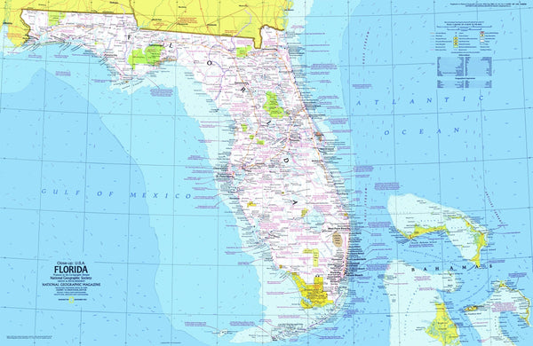
Explore the "Sunshine State" with this informative map of Florida. Part of the "Close-up: U.S.A." series, this map is half of a two-map set published in November 1973. With the wilderness of the Everglades, Miami's cosmopolitan beaches, and the fun of Disney World, it's no wonder Florida is one of the most popular tourist destinations in the United States.
The 1973 Florida map features• Historical notes and information about events and sites
• National parks, national and state forests, state historical and recreational parks, national wildlife refuges, Indian reservations, recreational trails, and wild or scenic rivers
• Cities and towns
• Interstate highways, other roads, passenger railroads, navigable canals, intracoastal waterways, and airports
• Rivers, lakes, intermittent lakes, and swamps
• Ocean bathymetry, warm currents, and reefs
• Geographical equivalents
Coverage Area: Florida
View our Florida Maps collection with over 100 maps of Florida
| Geotype | State |
|---|---|
| Map Type | Historical Maps |
| Publisher | NG Classic |
| Usage Type | Classroom Maps |


